
Land Stack & Glossary of Revenue Terms: India's Next Step in Digital Land Governance
UPSC CURRENT AFFAIRS 2026 GS PAPER II & III LAND GOVERNANCE
Land Stack India: The Digital Revolution in Land Records, Property Rights and GIS Governance
Understand Land Stack, DILRMP 3.0, Glossary of Revenue Terms, Bhu-Aadhaar, GIS mapping, land reforms and UPSC PYQs.
1. Why Is Land Stack in the News?
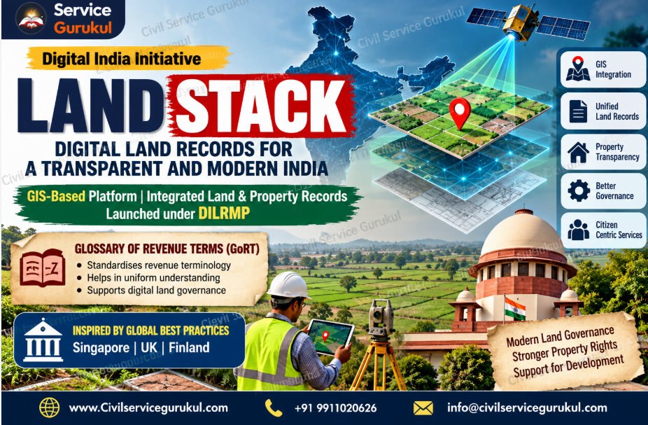
The Government of India launched Land Stack and released the Glossary of Revenue Terms (GoRT) on 31 December 2025.
These initiatives form part of efforts to modernise land administration under the Digital India Land Records Modernization Programme (DILRMP).
Land Stack is an integrated Geographic Information System (GIS)-based digital platform designed to bring together land and property information.
The initial pilot locations were Chandigarh and Tamil Nadu.
2. What Is Land Stack?
Land Stack is a GIS-based digital framework intended to integrate information maintained by different land-related departments.
It draws inspiration from international land administration practices in countries such as Singapore, the United Kingdom and Finland.
Core Objectives
- Provide integrated access to land-related information.
- Improve transparency in property transactions.
- Support informed decisions by citizens.
- Improve coordination between departments.
- Reduce fragmented land information.
- Support evidence-based government planning.
3. Key Features of Land Stack
GIS Integration
Connects land information with geographical and spatial maps.
Single-Window Access
Aims to reduce the need to consult several departments separately.
Interoperability
Supports exchange of information between land-related systems.
Transparency
Can improve access to relevant property information.
Better Due Diligence
Can help identify certain property-related risks before transactions.
Data-Driven Planning
Supports informed administrative and development decisions.
4. What Is the Glossary of Revenue Terms?
GoRT stands for Glossary of Revenue Terms.
It was released to address differences in land-revenue terminology across Indian States.
Historical revenue systems have produced diverse regional terminology.
For example, terms such as Khasra and Dag may be used in different regional land-record systems.
Important Features
- Provides explanations of land-revenue terminology.
- Includes vernacular, Hindi, English and Roman-script forms.
- Helps officials interpret regional terminology.
- Supports comparability and interoperability.
- Does not replace State-specific terminology.
Institutional Development
GoRT was prepared by the Department of Land Resources in collaboration with the Centre of Excellence in Land Administration and Management at YASHADA, Pune.
5. Digital India Land Records Modernization Programme
DILRMP aims to modernise land records and create a comprehensive, transparent land-information management system.
Background
- The National Land Records Modernization Programme was approved in 2008.
- It was subsequently revamped as DILRMP.
- From 1 April 2016, DILRMP became a Central Sector Scheme with 100% Central funding.
Main Objectives
- Digitisation of land records.
- Digitisation of cadastral maps.
- Integration of textual and spatial records.
- Modernisation of registration systems.
- Reduction of land disputes.
- Prevention of fraudulent transactions.
- Improved access to land information.
6. DILRMP 3.0: Important 2026 Update
On 10 September 2026, the Government launched operational guidelines for DILRMP 3.0.
The programme covers 2026–2031 and has an approved outlay of ₹565.50 crore.
Major Components
| Component | Purpose |
|---|---|
| National Land Stack | Federated integration of State land-information systems. |
| Bhu-Aadhaar / ULPIN | 14-digit unique identifier for land parcels. |
| Georeferenced Maps | Improved spatial accuracy of cadastral information. |
| Registration Seva Kendras | Modernised citizen-friendly registration services. |
| Legacy Record Scanning | Digital preservation of historical records. |
| Registration Repository | Integrated deed and encumbrance information. |
| Paperless Revenue Courts | Improved case management and links with land records. |
| NAKSHA | GIS-based urban land mapping. |
What Is Bhu-Aadhaar?
The Unique Land Parcel Identification Number (ULPIN), popularly called Bhu-Aadhaar, is a 14-digit identifier designed for land parcels.
It helps establish a consistent parcel identity across digital land systems.
7. Role of GIS in Land Administration
GIS stands for Geographic Information System.
It enables information to be linked with geographical locations and spatial maps.
Applications in Land Governance
- Mapping land parcels.
- Identifying spatial boundaries.
- Supporting land-use planning.
- Comparing maps with textual records.
- Improving infrastructure planning.
- Supporting disaster-risk assessment.
What Is a Cadastral Map?
A cadastral map represents land parcels and their boundaries for land administration purposes.
Digitisation and georeferencing can help connect such maps with Records of Rights.
8. Constitutional and Governance Significance
Constitutional Dimension
Land administration is primarily a State subject.
Entries 18 and 45 of the State List are relevant to land and land revenue.
The Union Government supports modernisation through financial and technical assistance.
Cooperative Federalism
A federated Land Stack can support interoperability while allowing State authorities to retain control over their respective datasets.
Economic Significance
- Better property due diligence.
- Potential reduction in fraudulent transactions.
- Improved access to relevant land information.
- Support for agricultural credit.
- Improved infrastructure planning.
- Potential reduction in administrative transaction costs.
9. Challenges and Way Forward
Major Challenges
- Inaccurate legacy records.
- Differences in State revenue systems.
- Mismatch between textual records and maps.
- Unresolved ownership disputes.
- Cybersecurity and privacy concerns.
- Unequal administrative capacity.
- Digital literacy and access barriers.
Way Forward
- Improve field-level record verification.
- Strengthen cadastral surveys.
- Adopt interoperable data standards.
- Provide accessible grievance redressal.
- Protect sensitive property information.
- Improve training of revenue officials.
- Coordinate registration, revenue and survey systems.
10. UPSC Prelims Quick Revision
| Topic | Important Fact |
|---|---|
| Land Stack | Integrated GIS-based land-information platform |
| Launch Date | 31 December 2025 |
| Initial Pilots | Chandigarh and Tamil Nadu |
| GoRT | Glossary of Revenue Terms |
| Nodal Department | Department of Land Resources |
| Ministry | Ministry of Rural Development |
| DILRMP | Digital India Land Records Modernization Programme |
| DILRMP 3.0 | Operational guidelines launched in September 2026 |
| ULPIN | Unique Land Parcel Identification Number |
| Bhu-Aadhaar | 14-digit land-parcel identifier |
| GIS | Geographic Information System |
| Land | State List, Entry 18 |
| Land Revenue | State List, Entry 45 |
11. UPSC Mains Answer-Writing Strategy
GS Paper II
Discuss e-governance, transparency, accountability, citizen services and cooperative federalism.
GS Paper III
Explain land reforms, agricultural productivity, property rights, institutional credit and economic development.
12. Conclusion
Land Stack represents a shift from fragmented digital land records towards integrated, GIS-enabled land governance.
Together with GoRT and DILRMP 3.0, it can support better administrative coordination, property-related transparency and evidence-based planning.
However, successful reform will require accurate records, legal safeguards, interoperability and effective grievance redressal.
13. UPSC Previous Year Questions and Practice MCQs with Answers
Part A: Verified UPSC PYQs
PYQ 1: DILRMP
With reference to the Digital India Land Records Modernization Programme, consider the statements:
- The Central Government provides 100% funding.
- Cadastral maps are digitised.
- An initiative supports transliteration of Records of Rights from local languages into Constitution-recognised languages.
(A) 1 and 2 only
(B) 2 and 3 only
(C) 1 and 3 only
(D) 1, 2 and 3
Correct Answer and Explanation
Statement 1: Correct. DILRMP is a Central Sector Scheme with 100% Central funding.
Statement 2: Correct. Digitisation of cadastral maps is an important component.
Statement 3: Correct. Transliteration of Records of Rights supports wider language accessibility.
Land Stack Link: Land Stack builds on digitised and interoperable land information.
PYQ 2: Success of Land Reforms
What factors contributed to the successful implementation of land reforms in certain parts of India? Elaborate.
Suggested Answer and Explanation
- Political will and administrative commitment.
- Implementation of tenancy reforms.
- Enforcement of land-ceiling provisions.
- Updating land records.
- Public awareness and local participation.
- Effective grievance redressal.
Land Stack Link: Integrated digital records can improve transparency and administrative efficiency, but do not replace substantive land reforms.
PYQ 3: Objectives and Measures of Land Reforms
State the objectives and measures of land reforms in India. Explain how land-ceiling policy can be considered an effective reform under economic criteria.
Suggested Answer and Explanation
Major measures:
- Abolition of intermediaries.
- Tenancy reforms.
- Land-ceiling legislation.
- Consolidation of holdings.
- Updating land records.
Land-ceiling measures seek to limit excessive concentration of land and enable redistribution of surplus land, subject to implementation.
Land Stack Link: Accurate land records can assist implementation, monitoring and verification of reforms.
PYQ 4: Marginal and Small Farmers
How did land reforms in certain parts of India help improve the socio-economic conditions of marginal and small farmers?
Suggested Answer and Explanation
- Improved security of land tenure.
- Reduction in exploitative tenancy arrangements.
- Greater access to productive assets.
- Improved incentives for investment.
- Potential improvement in credit access.
- Stronger socio-economic position of farmers.
Land Stack Link: Accessible and reliable land records can support farmers in documentation and institutional transactions.
PYQ 5: Land Reforms and Agricultural Development
Discuss the role of land reforms in agricultural development. Identify factors responsible for their success in India.
Suggested Answer and Explanation
- Reduction of exploitative intermediaries.
- Improved land-tenure security.
- Consolidation of fragmented holdings.
- More equitable land distribution.
- Better incentives for agricultural investment.
- Stronger administrative implementation.
Land Stack Link: Digital land information can strengthen implementation capacity and transparency.
Part B: Original UPSC-Style Practice MCQs
Land Stack Launch
Land Stack was initially launched as a pilot in which locations?
(A) Kerala and Delhi
(B) Chandigarh and Tamil Nadu
(C) Gujarat and Maharashtra
(D) Assam and Odisha
Correct Answer and Explanation
The initial pilot locations were Chandigarh and Tamil Nadu.
Glossary of Revenue Terms
What is the main purpose of GoRT?
(A) Replace all State land laws
(B) Harmonise understanding of land-revenue terminology
(C) Fix agricultural market prices
(D) Determine property tax rates
Correct Answer and Explanation
GoRT helps users understand regional land-revenue terminology without replacing State-specific terms.
Bhu-Aadhaar
ULPIN is primarily:
(A) A 12-digit citizen identifier
(B) A 14-digit land-parcel identifier
(C) A farm insurance policy number
(D) A property tax exemption certificate
Correct Answer and Explanation
ULPIN, or Bhu-Aadhaar, provides a 14-digit identifier for land parcels.
Constitutional Distribution of Powers
Land is primarily included in which constitutional list?
(A) Union List
(B) State List
(C) Concurrent List
(D) Residuary Powers
Correct Answer and Explanation
Land is covered by Entry 18 of the State List in the Seventh Schedule.
GIS Technology
What is the full form of GIS?
(A) Government Information Service
(B) Geographic Information System
(C) General Infrastructure Survey
(D) Global Investment Scheme
Correct Answer and Explanation
GIS stands for Geographic Information System. It is used to organise and analyse information linked to geographical locations.
- Digitisation of land records.
- Land reforms and agricultural productivity.
- Land-ceiling legislation.
- Tenancy security and farmers' welfare.
- Land administration and transparency.
- GIS, cadastral maps and property records.
Prepare UPSC & State PCS with Civil Service Gurukul
Learn Polity, Governance, Economy, Geography and Current Affairs through conceptual notes, PYQs and structured preparation.
Explore NCERT Foundation Course Enquire on WhatsAppPrepare with Mentors Who Cleared the Exam
Get personalized study plans, evaluated answer models, and test series access.